


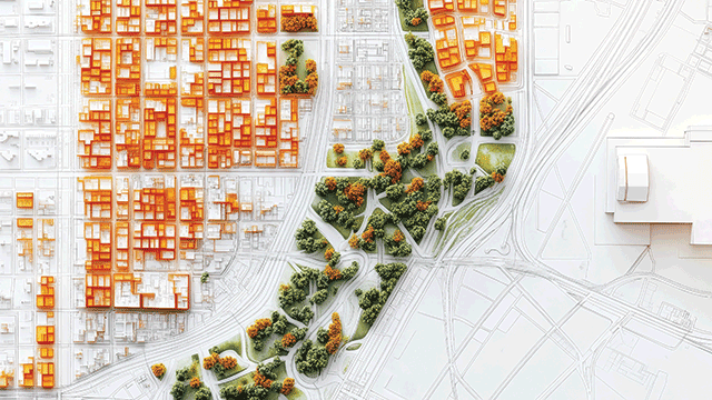

Views are being sought on the government’s land use in England consultation. This will form the development of the government’s long-promised land use framework and we have until 25 April to comment. Much is made of a spatial approach (more on that later). The new framework will need to work alongside a plethora of other strategies, plans and road maps. For example, the environmental improvement plan, a 25-year road map for farming, a food strategy and a strategic spatial energy plan. There is also a vision. Space also has to be found for 1.5m new homes in there as well. Perhaps the collective noun for these documents should be a jigsaw. They will certainly look like a puzzle to an estate manager contemplating the medium to long term.
Vision for English land use
The vision has five parts:
- Space for nature recovery, water and emissions reduction. This is because of legally binding targets under the Environment Act 2021 and the Climate Change Act 2008.
- Support for sustainable and resilient food production.
- Delivery of new infrastructure and housing.Fixing the foundations for resilient long-term economic growth. This is about natural capital and resilience against climate changes.
- Co-creation of plans for delivery. The government would like to collaborate with us all.
- The 1.5m new homes are mentioned several times, but will not require much in the way of land use change. Despite appearances to the contrary, 85% of England is still classed as rural, 67% of the total area being farmland. Despite all this, 83% of the population live in urban settlements of more than 10,000 inhabitants.
The consultation document goes on to offer five categories of change that may be needed in the use or management of England’s agricultural land by 2050. The five categories are:
- Land management change, ie changes in the way we farm (category 1). Outside the scope of this consultation. We must look forward to the farming road map for category 1.
- Small changes maintaining the same agricultural land use (category 2) – will affect about 123,500 acres or 0.5% of the agricultural land area. Typically field margins and riparian areas turned over to buffer areas.
- Changes in agricultural land use for food, environmental and climate benefits (category 3.1). About 914,300 acres or 4% involved here. Basically this means more trees.
- Changes in agricultural land use for environmental and climate benefits therefore limiting food production (category 3.2). About 1.06m acres here, 5%. Typically to include species-rich grasslands, peatland management schemes, establishment of short rotation coppice.
- Completely new non-agricultural uses for environmental and climate benefits (category 4). About 1.87m acres or 9%. Could be new woodlands, peatland restoration, creating or restoring coastal and lowland heath habitats.
This adds up to change in the latter four categories (2, 3.1, 3.2 and 4) affecting 19% of our farmland area by 2050. Circa 10% is said to be about making land more multifunctional alongside food production. Housing land requirements are put in perspective by the statement that only 1.1% of farmland will be needed: 74,100 acres in this parliament and 370,000 acres by 2050. New infrastructure will require much less.
Spatial approach
Five principles are offered for the spatial approach:
- Co-design: Locally and regionally including an assessment of the fairness of changes in land use. We might wonder what “fair” means in this context?
- Multifunctional land: Mixing opportunity, societal needs and environmental pressures. Societal needs include ready access to nature from new housing.
- Playing to the strengths of land: This means more than just the potential of the land itself. The example given is access to the grid for new renewable energy sites. Witness the recent appeal decision at Old Malton (APP/Y2736/W/24/3342002) where tenant farmers Rob and Emma Sturdy will lose a large part of the tenanted farm which has been in their family for three generations because access to the grid was prioritised over agricultural land quality and the sustainability of a farm business.
- Decisions fit for the long-term: Emphasising resilience in the long term, eg homes that can withstand flooding and over-heating.
- Responsive by design: This means responding to new data, opportunities and pressures.
To support all this a need is recognised for:
- Aligned incentives: Things such as grants and new market opportunities.
- Joined-up decisions on land use change: This is about planning and spatial development strategies are mentioned, a so-called universal system of strategic planning which will be led by combinations of county councils, unitary authorities and devolved authorities (the new mayoral areas). Strategic development strategies will set the overarching spatial strategy for local plans. Does this hark back to the role of regional government offices and regional development agencies?
- Accessible and high-quality data: Making it useful at the level of an individual field and easy to use.
- The right skills in the right places: Ominously, the government wants to enable the alignment of farm plans with local and national priorities and will consider how to achieve this through trusted advisers, guidance and services. What if a farmer doesn’t want to use a “trusted adviser”? Who is to certify the trusted advisers?
Still with me? Study the spatial data maps in the analytical annex for your area. Take Suffolk and Cheshire, for example. Both have a high potential for broadleaf tree planting; both have a medium potential for habitat creation and restoration; both have good potential to combine trees with food production; both are good for creating and restoring habitat alongside planting trees; and both have a higher potential for food production than they do for habitat. Have we learnt anything new about this from the consultation paper, or is this beginning to sound like an O-Level geography lesson?
Respond to the consultation by 25 April at: www.gov.uk/government/consultations/land-use-in-england
Image © Adobe Stock
